Gwynedd Archaeological Trust
Regional Historic Environment Record

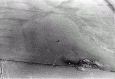
Standing Stone, Bodewryd, Rhosybol

Primary Reference Number (PRN) : 3543
Trust : Gwynedd
Community : Mechell
Unitary authority : Ynys Mon
NGR : SH4062490219
Site Type (preferred type first) : BRONZE AGE STANDING STONE
Status : Scheduled Monument

Description :
Maen Hir, 700yds ESE of the Church of St. Mary, 13ft high, 6ft wide and 2ft thick. Some packing stones visible at base. (RCAHMW, 1937)

Standing stone (SH 40629021) (LB). <2>

The standing stone is as described. Published survey 25" correct. <3>

Condition unchanged. Published survey 25" correct. <4>

Standing stone 12ft high by 3ft by 2ft. <5>

A standing stone 4m high by 1.9m by 0.75m. There is some erosion around the base of the stone, which has exposed a number of packing stones. <6>

Stone called Praes Maen on account of a brass pot being placed near it. Standing upright in middle of a field 13ft high, 14ft circumference, 4 or 5ft underground. <7>

3.75m high, 1.6m wide, leans slightly to E. <9>

Tall slab of local stone standing on a slight rise in undulating grassland, visible from all but W for several miles but only on horizon locally - When viewed from a distance sits in natural hollow 500m across. Slab roughly rectangular and tapers (widthways) at top - leans a few degrees to ESE. (Smith, 2003)

“It is standing upright in the midst of a field and measures thirteen feet high and fourteen or fifteen in circumference, allowing four or five feet under ground.” (Skinner, 1802) (Sketch on p. 65, depicting two other standing stones nearby) (Fenton, 1802).

Sources :
Cooke, N. , 2014 , Rhyd-y-Groes Repower, Anglesey: Cultural Heritage Assessment. ( © Wessex Archaeology)
Dickson, C. & Tram, N. , 2015 , Stone, Hilltops, Water and the Sun: A Preliminary Investigation into the Orientations of Standing Stones Near the River Alaw, Anglesey , Archaeology in Wales : Vol. 54 : p. 43-52
Hadley, A. , 2016 , Proposed Wind Turbine at Nant-y-fran, Cemaes, Isles of Anglesey. Cultural Heritage Impact Assessment. ( © Archaeology Wales)
Lynes, M. , 2012 , How do the Standing Stones of Anglesey 'Stand'?
Skinner, Rev J. , 1908 , Ten Days' Tour Through The Isle of Anglesea, December 1802
Smith, G. , 2003 , Prehistoric Funerary and Ritual Monument Survey: West Gwynedd and Anglesey ( © GAT)
Smith, G., and Steele, N. , 2005 , Pan-Wales Prehistoric Funerary and Ritual Sites Survey: Trial Data Synthesis ( © GAT)
The Royal Commission on the Ancient and Historical Monuments of Wales , 1937 , An Inventory of the Ancient Monuments in Anglesey
Ordnance Survey , 1963 , SH49SW 3 , <2>
Royal Commission on Ancient and Historic Monuments , Tafarn Hwyaid Maenhir , <7>
Lynch, F. , 1970 , Prehistoric Anglesey , <8>
Ordnance Survey , 1968 , SH49SW 3 , <3>
Ordnance Survey , 1969 , SH49SW 3 , <4>

Events :
42851 : An 078 Fmw Site Visit (year : 1986)
42852 : An 078 Fmw Site Visit (year : 1992)
40526 : Prehistoric Funerary and Ritual Monument Survey: West Gwynedd/Anglesey (year : 2003)
45013 : Rhyd-y-Groes Repower, Anglesey: Cultural Heritage Assessment. (year : 2014)
40527 : Pan-wales Prehistoric Funerary and Ritual Sites Survey: Trial Data Synthesis (year : 2005)
45130 : Proposed Wind Turbine at Nant-y-fran, Cemaes, Isle of Anglesey. Cultural Heritage Impact Assessment. (year : 2016)

Related records
National Monuments Record Wales NPRN 302467 https://coflein.gov.uk/en/site/302467/

Compiled date : 16-12-1986


Images :


The above data are supplied by GAT in partnership with its Local Authorities (Anglesey, Conwy and Gwynedd County Councils, and Snowdonia National Park Authority), © GAT 2025 (and in part © Crown, 2025 - as indicated)
This information is supplied for the purposes of personal interest only and may not be used as part of a commercial project.

March 29, 2025, 2:25 am - HTML file produced from Gwynedd Archaeological Trust Regional HER
Gwynedd Archaeological Trust, Craig Beuno, Garth Road, Bangor, Gwynedd.  LL57 2RT
tel (01248) 352535,  fax (01248) 370925, email her@heneb.co.uk, web www.heneb.co.uk